Spain
 |
|
Contact person for provided information:
Colegio Oficial de Ingeniería Geomática y Topográfica (COIGT)
Avenida Reina Victoria 66, 2ºC. 28003 Madrid (Spain)
coigt@coigt.com
Part 1: Country Report
A. Country Context
A.1 Geographical Context
Spain is a country located in southwestern Europe occupying most (about 85 percent) of the Iberian Peninsula and includes a small exclave inside France called Llívia as well as the Balearic Islands in the Mediterranean, the Canary Islands in the Atlantic Ocean 108 km (67 mi) off northwest Africa, and five places of sovereignty (plazas de soberanía) on and off the coast of North Africa: Ceuta, Melilla, Islas Chafarinas, Peñón de Alhucemas, and Peñón de Vélez de la Gomera.
The Spanish mainland is bordered to the south and east almost entirely by the Mediterranean Sea (except for a small land boundary with Gibraltar); to the north by France, Andorra, and the Bay of Biscay; and to the west by the Atlantic Ocean and Portugal. With an area of 504,030 km², Spain is the second largest country in Western Europe (behind France) and with an average altitude of 650 m, the third highest country in Europe (behind Switzerland and Austria).
Its total area is 504,782 km2 (194,897 sq mi) of which 499,542 km2 (192,874 sq mi) is land and 5,240 km2 (2,023 sq mi) is water.[1] Spain lies between latitudes 36° and 44° N, and longitudes 19° W and 5° E. Its Atlantic coast is 710 km (441 mi) long. The Pyrenees mountain range, extends 435 km (270 mi) from the Mediterranean to the Bay of Biscay. In the extreme south of Spain lie the Straits of Gibraltar, which separate the Iberian peninsula and the rest of Europe from Ceuta and Morocco in north Africa; at its narrowest extent, Spain and Morocco are separated by only 13 km (8.1 mi).
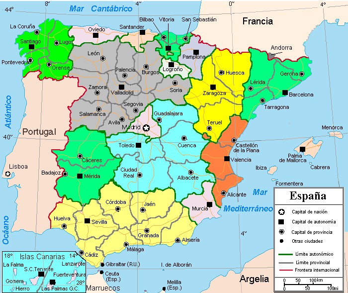
Spain and its regions and provinces
A.2 Historical Context
Iberia enters written records as a land populated largely by the Iberians, Basques and Celts. After an arduous conquest, the peninsula came under the rule of the Roman Empire. During the early Middle Ages it came under Germanic rule but later, much of it was conquered by Moorish invaders from North Africa. In a process that took centuries, the small Christian kingdoms in the north gradually regained control of the peninsula. The last Moorish kingdom fell in the same year Columbus reached the Americas. A global empire began which saw Spain become the strongest kingdom in Europe, the leading world power for a century and a half, and the largest overseas empire for three centuries.
Continued wars and other problems eventually led to a diminished status. The Napoleonic invasions of Spain led to chaos, triggering independence movements that tore apart most of the empire and left the country politically unstable. Prior to the Second World War, Spain suffered a devastating civil war and came under the rule of an authoritarian government, which oversaw a period of stagnation that was followed by a surge in the growth of the economy. Eventually democracy was peacefully restored in the form of a parliamentary constitutional monarchy. Spain joined the European Union, experiencing a cultural renaissance and steady economic growth.
A.3 Current Political and Administrative Structures
The Spanish Constitution of 1978 is the culmination of the Spanish transition to democracy. The constitutional history of Spain dates back to the constitution of 1812. Impatient with the slow pace of democratic political reforms in 1976 and 1977, Spain's new King Juan Carlos, dismissed Carlos Arias Navarro and appointed the reformer Adolfo Suárez as Prime Minister.
The resulting general election in 1977 convened the Constituent Cortes (the Spanish Parliament, in its capacity as a constitutional assembly) for the purpose of drafting and approving the constitution of 1978. After a national referendum on 6 December 1978, 88% of voters approved of the new constitution.
As a result, Spain is now composed of 17 autonomous communities and two autonomous cities with varying degrees of autonomy thanks to its Constitution, which nevertheless explicitly states the indivisible unity of the Spanish nation. The constitution also specifies that Spain has no state religion and that all are free to practice and believe as they wish.
A.4 Historical Outline of Cadastral System
In 1750 of the Crown of Castile was commenced. Following this attempt the tax on harvests, real estate and cattle, that was based on amillaramientos a sort of declaration.
The 19th century went through with much debate and little change. The 20th century brought the Law of the Parcellary Topographical Cadastre, in 1906, however, for various reasons this work stretched over decades, thus giving time for Spain to begin its process of urba n development.
After the 1906 Law various other regulations merged, from the law of 26 september 1941 and laws 39/1988, 13/1996, 66/1997, 6/1998, 24/2001 and 53/2002 regulating isolated aspects of the cadastral works and cadastral use and adapting the procedures to the new scenaries and tecnologies.
Along this years the Spanish Cadastre was become a complete, reliable and technological data base describing real estates, with the main proupose of provide the values that are the basis of the local real estate tax, but also to ensure the real estate trade market system and to provide a huge reliable data base for many other purposes.
Finally, in 2004 the law of Real Estate Cadastre “Real Decreto legislativo 1/ 2004, de 5 de marzo, por el que se aprueba el Texto Refundido de la Ley del Catastro Inmobiliario” was ratificaded by the Parlament. This law represents an effort to cover all cadastral regulations with legal effect that are currently valid, providing a new systematic organisation and making the whole clearer and more harmonious. Tow years later the reglamentary development of the law was approved “Real Decreto 417/2006.
Since the early 1990s, the Spanish cadastre has met its public task by collecting information in digital format, being a government tax collection and a real estate security service
In 2003 the electronic office of cadastre was created and during the years of operation, there has been a dramatic increase in use of data that has been stimulated by a progressive increase in the services offered. These were provided following this timeline:
- In 2003, some information was made available online
- In 2004, all cadastral mapping was available online.
- In 2005, the Web Map Server (WMS) was launched.
- In a Web Feature Service (WFS) was implemented for registered users.
- In 2007, more interactive services for citizens and government were created.
- In 2008, new services were made available with SOAP (which allows more effective searches).
- In 2009, a four-dimensional Interchange Format KML was implemented.
- In 2010 the Electronic Office of the cadastre was created. Since 2010, this virtual office allows electronic land registration procedures and provides editable WFS and other formats for public administrations.
- In 2011, with the adoption of the Sustainable Economy Act, every citizen may obtain editable WFS and other formats (maps and alphanumeric information in interoperable formats) through licensing.
- Electronic notifications.
•2012 Electronic Document.
•2013 Digitization
- 2014-2017 Regularization process...Massive inspection aimed to combat real estate tax fraud and to boost local finance
- 2015 New law for coordination cadastre and land registry
- 2018 New valuation methodology
B. Institutional Framework
B.1 Government Organizations
The Spanish General Directorate for Cadastre (SGDC), within the Ministry of Finance is responsible of creation, maintenance and diffusion of cadastral data. Spanish law establishes that the Cadastre is a register describing rural, urban and special characteristics real estates The SGDC is responsible for the creation, maintenance and diffusion of cadastral data either directly or in collaboration with local authorities and other public entities. Therefore, the Cadastral Information System is a dynamic, open system with numerous flows of interchange of information with multiple external agents who interact with the Cadastre’s databases both as suppliers of information and as users and client.
SDGC carries out its functions through its central head office in Madrid, 15 regional offices and 56 provincial offices. There are also about 3,800 cadastral information points (PIC), authorized by the SDGC in various public organisations and institutions, mainly in municipal and Provincial Councils and distributed throughout the territory, where citizens can access cadastral information and obtain certificates.
In order to maintain update the cadastral data base, the SDGC works with 2.300 cadastre civil servants, 93% in regional and province offices, and has agreements with 5000 Pubic Administrations and Institutions, municipalities, public notaries, property registrars, etc… that update the cadastral information permanently as intermediaries in the relationship between the Cadastre and citizens.
B.2 Private Sector Involvement
In Spain there are not licensed surveyors and it is not obligatory to mark boundaries in the ground.
But any alteration of the real estate must be declared to the cadastre. Mostly, when the parcels have physical changes, it is a surveyor who include the new coordinates in the cadastre contracted sometimes by citizen but mostly by other public administration.
The Spanish cadastre is elaborated on topographic digital maps, in case of the urban cadastre, and digital ortophotographies, in case of the rural cadastre, that has been done before to the cadastral works. (The Cadastral Cartography is considered legally as thematic cartography elaborated on a basic cartography that has been obtained by direct processes of observation and measurement of the terrestrial surface (Law 7/1986 of Ordination of the Cartography)
The topographic digital cartography (apparent parcelary) and the digital ortophotographies are elaborated principally by other regional and local administrations and put at the disposal of the cadastre by means of agreement.
In the exceptional case of which this basic cartography does not exist to a suitable scale, the Spanish cadastre can contract his elaboration to companies specializing in digital cartography. And the technical engineers in topography of the cadastre are the civil servants who control the topographic quality of the works done by these companies.
On this basic cartography, the Spanish Directorate General for Cadastre contracts later the elaboration of the cadastre to companies that have multidisciplinary teams with: Technical Engineer in Topography, superiors engineers, computer science technicians, and personnel of support.
Likewise, the work of these companies are directed and controlled by the technical staff of the cadastre, all Civil Servants from every speciality: Agricultural and Forest Engineers and Architects, lawyers, Computer science technicians and, off course, Technical Engineer in Topography.
On the other hand, the Article 3. of the LAW OF THE REAL-ESTATE CADASTRE RDL 1/2004, specifies that the information contained in the Real-estate Cadastre is presumed as certain, except proof in opposite, and without prejudice of the records of the Property Land, which juridical pronouncements will prevail.
So, only if as result of all these works, that we have described above, a citizen thinks that the graphical and alphanumeric description and the surface of his Real Estate has been incorrectly reflected, he can contract the services of a collegiate Technical Engineer in Topography to make the topographic planes to reaching as proof to the cadastre, that will confront it with other proofs with the aim of reflect the reality properly.
B.3 Professional Organization or Association
B.4 Licensing
Access to non protected data is free 24x7.
For massive download: Access to the Spanish Cadastre web services shall be carried out under a transfer of rights license to be obtained automatically, assuming with its use the knowledge and acceptance of the conditions of access and the license conditions that are listed below
Requirements for public use and dissemination of the information supplied
1. Downloading massive graphic and alphanumeric cadastral information and access to the cadastral web services are authorized to license holder user's own use, or for the development and distribution of new valueadded products from the cadastral information provided, always that this is transformed by the interested party.
This license authorizes the public use, including commercial, of cadastral information that has been the subject of any prior process of transformation in the terms established in article 21 of the consolidated text of the Intellectual Property Act, approved by Royal Legislative Decree 1/1996, of 12 April.
Consequently, the license does not authorized the diffusion, distribution or commercialization of the given original information, which cannot be spread either by Internet nor by any other way without its previous transformation
2. Download information and access to the web services of the electronic office of the cadastre implies the recognition and acceptance of the users of the possible existence of data outdated or incorrect. The Directorate General for Cadastre will try to put at the disposal of users updated versions of the information provided in previous periods, without involving any obligation of singular or periodic update of previously downloaded information.
3. The Directorate General for Cadastre shall in no case responsible for the products or services generated by the re-user from the transformation of the cadastral information downloaded. The information distributed to third parties by the interested party will lack of irrefutability with respect to the physical, legal or economic circumstances of the real estate registered in the Cadastre.
Beneficiaries of the massive download or web service to access to cadastral information should support the claims of third parties which may result in products of added value based on the information provided by the Directorate General of the Cadastre. The transformation of the cadastral information may not make alteration of the contents of the cadastral information or denaturing of its meaning. New products or services that may not supplant to those offered by the Directorate general for the cadastre
To these effects, it is understood that the new products or services generated supplant those offered by the Directorate general for Cadastre if they are identified as "cadastral cartography", "cadastral information", or equivalent terms that may lead to confusion.
Suspension of Service
The service will be suspended when the scheduled shutdown of the Cadastral Electronic office (Sede Electrónica del Catastro (SEC)), in which will be announced these in advance.
In this sense, it may suspend service to any user, during the download process, or during access to web services, is detected that its intensity, frequency or any other sudden circumstances go to the detriment of the performance of the access of other users, or the quality or safety of the service. In these cases, the system will automatically interrupt the download process or the information service and shall notify the person concerned the reasons which justify it, as well as the data of contact of the responsible for the service, to be informed of the alternatives to access the requested information. The Directorate General for Cadastre shall in no case be responsible for the effects that occur on the activity of the users as a result of scheduled or technical stops of the service.
Cases of revocation of the license
The Cadastre will do the revocation of the license previously granted when subsequent to delivery it will discover a misuse, proceeding in this case to the determination of responsibilities in the terms envisaged in article 78 of RD 417/2006. In accordance with the provisions of article 54 of the Law of Real Estate Cadastre, against the revocation of the license may be brought appeal with to the Director General of the Cadastre.
B.5 Education
C. Cadastral System
C.1 Purpose of Cadastral System
Spanish Cadastre possesses literal and graphic information of 78 million of real estates in an interoperable and homogeneous digital data model. Its completed and updated cadastral information is offered via internet to public and private users that can access free of charge 24 hours, 7 days a week, and that issue 77 million access and 330 million queries a year; 180 million maps download annually and 7 million certificates in 2017.
This description of the real estate in the cadastre includes physical, legal and economic characteristics; featuring location, cadastral reference, surface, usages, class of crop, buildings, graphic representation, cadastral value and the information of 28M title holders, with description of their rights (108 M), addresses, and national identification numbers. Not only cadastral parcels are included but also all constructions with their characteristics.
The Spanish Cadastre has as its main task not only to describe the real estates but also to give them a value. These values are the basis for the recurrent real estate tax, that is the main income of the Spanish municipalities, around 15.000 million euros. The valuation method of the Spanish cadastre for the massive valuation of the real estate is very much accepted by the different agents and citizens.
SDGC is also a territorial database allowing the location and identification of real estate for land registry and the assignment of the cadastral reference, as well as the supply of graphic and literal information to other public entities
The Spanish Cadastre is a pioneer public-sector organisation in its facilitation of access and re-use of its PSI for free for both commercial and non-commercial purposes. It has evolved from being a government tax collection and a real estate security service to be a socially valuable tool since this data is used in an increasing number of application and new services.
C.2 Types of Cadastral System
The General Directorate of the Cadastre of Spain is a Tax Administration and has a strong taxation vision of the cadastral data in a wide way.
This ensures the management of both cartographic and its alphanumeric associated datasets and will overcome the concept of cadastral data as if it were mere geographic information.
The Spanish Cadastre has extensive experience in the elaboration of automated valuations for taxation purposes, and in this moment is the main supplier of real estate values both to local and regional administrations as well to the Spanish Tax Administration Agency
C.3 Cadastral Concept
The General Directorate of the Spanish Cadastre propose a concept of strong operational interoperability between the different bodies potentially involved in the cadastral maintenance.
This includes the identification of such bodies and organisations, as well as the study of how periodical transfer of relevant data between administrations should be done in order to allow a coordinated and consisting way of collaborative interadministrative working, according to the inspire principle that the data should be captured and managed by the institution which is closer to the source of data.
According to this, the Spanish Cadastre has strong experience in a cadastral collaborative way of maintenance and receives relevant information by several operators that allow the updating of data concerning ownership (notaries, land registries, agricultural management authorities).
The Spanish Cadastre also receives information from notaries, ensuring the maintenance of the economic data of the real estate, through the capture in origin of the market values.
C.4 Content of Cadastral System
Spanish law establishes that the Cadastre is a register describing rural and urban real estates.
Real Estate Identification data:
cadastral reference, province, municipality, addresses or location.
Juridical data of real estate:
Titleholders’ name and national identity number, addresses of titleholders and the notification address, date of acquisition and rights data….
Physical data of real estate:
land area, representation of the Buildings (even with the description of every floor) buildings area, class of crops, conservation status of the constructions, use (legal and actual one), construction typology, year of construction…..
Economic data of the real estates:
value of land, value of construction and cadastral value, criteria and valuating module, real estate taxable value, exemptions and benefits.
3D cadastre:
For every building the database has sketched floorplan in digital form, the FXCC
IT is a scaled graphic representation of the properties forming an urban estate.
D. Cadastral Mapping
D.1 Cadastral Map
We have continuous, homogeneous. digital cartography GIS) of all our territory of management (almost 500,000 km2) available through the electronic office, viewer that allows users to navigate from an overview of the complete territory to approach each one of the parcels and units and also through the map access to the most relevant alphanumeric characteristics of them.
Cadastral cartography only represents cadastral parcels, while the different floor plans and interior spaces are represented on the FXCC. sketched floorplan in digital form.
With this data we can build the 3D information.
The Spanish cadastre do the maintenance and management of the cadastral cartography by digital means. This implies specific cartographic operations on the cadastral parcel map according to the alterations that are produced by the legal and economic operators, as well as the elaboration of specific layers that allow the automated processing of the cartographic and market data. This includes the generation of layers of thematic cartography oriented to the automated valuation sectorisation and the generation of layers of urban cartography.
Various mechanisms that guarantee the maintenance of cartographic layers oriented to cadastral maintenance and its assessment will be analysed and proposed.
The proposal highlights the fact that the cadastral cartography is an instrument at the service of real estate taxation and not a mere cartographic territorial description.
D.2 Example of a Cadastral Map
D.3 Role of Cadastral Layer in SDI
We are the main data provider in the Spanish Spatial data infrastructure.
Among the numerous services offered by the Cadastre Electronic Office, the INSPIRE services, the Spanish cadastre provides INSPIRE visualization services (WMS) and INSPIRE download services (WFS and ATOM) of the 3 INSPIRE themes that are its responsibility: cadastral parcels, buildings and addresses. And is the main data provider in the spatial data infrastructure of Spain.
E. Reform Issues
E.1 Cadastral Issues
Reform introduced legally in 2015 established that the description of properties in the Property Rights Registry is to be done by a geo-referenced graphical representation. •The graphic geo-referenced description of the Property Rights Registry is based on the cadastral cartography.
Once the cadastral data have been incorporated in the real estate information in the Property Rights Registry, the delimitation, location and area data are considered to be true for all legal purposes. The Property Rights Registry`s record will also indicate if the real estate is coordinated with the Cadastre and the date of coordination
E.2 Current Initiatives
Several initiatives are:
In Cartography:
-When the cadastre also becomes the basis of the registration of the properties, as has happened in Spain with Law 13/2015, which indicates that once coordinated a property between cadastre and property right register, the area and location of the property in cadastre becomes legal value; the quality of the graphic representation becomes fundamental.
Therefore the strategic plan of Spanish Directorate for cadastre includes the process to update both the positional accuracy of cadastral cartography as the correct reflection of the real estate on it.
In valuation:
Improve the efficiency of cadastral valuation processes: the value of real estate continuously updated.
Spanish cadastre is defining a new methodology that allows defining annually for each property of all municipalities a reference value
The reference value will be the limit of the cadastral value, which according to the cadastre law, cannot exceed the market value.
This market-referenced value is sustainable even in a changing real estate market scenario; is agile and doesn’t depend of the municipal councils decision.
The publicity of the reference values increase the transparency and legal certainty of the real estate market helping to prevent phenomena as housing bubble
F. References
Part 2: Cadastral Principles and Statistics
1. Cadastral Principles
1.1 Type of registration system |
|
title registration
deeds registration |
1.2 Legal requirement for registration of land ownership |
|
compulsory
optional |
1.4 Approach for establishment of cadastral records |
|
systematic
sporadic both, systematic and sporadic all properties already registered |
2. Cadastral Statistics
2.1 Population |
46,570,000 |
2.2a Population distribution: percentage of population living in urban areas |
70 |
2.2b Population distribution: percentage of population living in rural areas |
30 |
2.3 Number of land parcels |
44,000,000 |
--- Number of land parcels per 1 million population |
944,800 |
2.4 Number of registered strata titles/condominium units |
39,000,000 |
--- Number of strata titles/condominium units per 1 million population |
837,400 |
2.5 Legal status of land parcels in URBAN areas: |
|
percentage of parcels ESPt are properly registered and surveyed |
0 |
percentage of parcels ESPt are legally occupied, but not registered or surveyed |
0 |
percentage of parcels ESPt are informally occupied without legal title |
0 |
2.6 Legal status of land parcels in RURAL areas: |
|
percentage of parcels ESPt are properly registered and surveyed |
0 |
percentage of parcels ESPt are legally occupied, but not registered or surveyed |
0 |
percentage of parcels ESPt are informally occupied without legal title |
0 |
2.7 Number of active professional land surveyors |
0 |
2.8 Proportion of time ESPt active professional land surveyors commit for cadastral matters (%) |
0 |
--- Approx. full-time equivalent of land surveyors committed to cadastral matters |
0 |
2.9 Number of active lawyers/solicitors |
0 |
2.10 Proportion of time ESPt active lawyers/solicitors commit for cadastral matters (%) |
0 |
--- Approx. full-time equivalent of active lawyers/solicitors committed to cadastral matters |
0 |